

- First Timer: Easter Island (tips and hints to make your first visit easier)
- Easter Island Day 1: The Lesser-Visited East Side of Rano Kau
- Easter Island Day 2: Moai Abound
- Easter Island Day 3: The West End of Easter Island [to come]
- More pictures on Flickr
sunrise
the day started “early”, heading out to our sunrise destination at 7 AM. sunrise was a smidge after 8 AM but the guide wanted to get there early just in case.
normally, most people go to sunrise at Tongariki but we (my guide and i) made a joint decision to instead go back up to the Rano Kau crater (where i started my Easter Island journey), since during the winter months, the sun comes up from the left, over Poike, so it’s not as stunning. we figured that, in addition to having the place to ourselves, watching dawn arrive with a view over the city and lighting up the crater would be a nice alternative.
and twas. what was also great was just standing up there, in nature’s solitude, the only sounds being the chirping of crickets, the wind whooshing by my ears, and the waves far below. several times i closed my eyes, turned into the wind, and let myself be enveloped by my surroundings. absolute serenity.
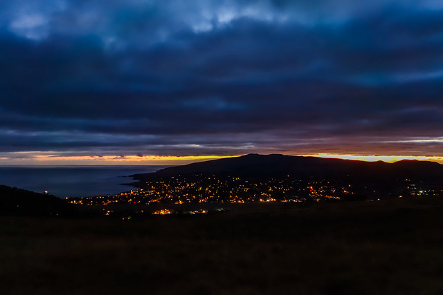
The city was still very much asleep

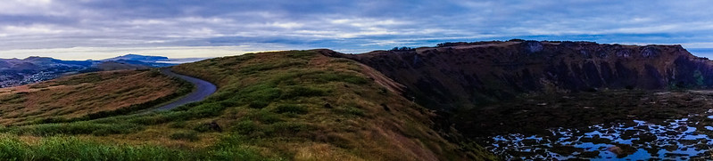
A panorama of the area we were standing in, with the crater lake to the right and the city offscreen to the left.
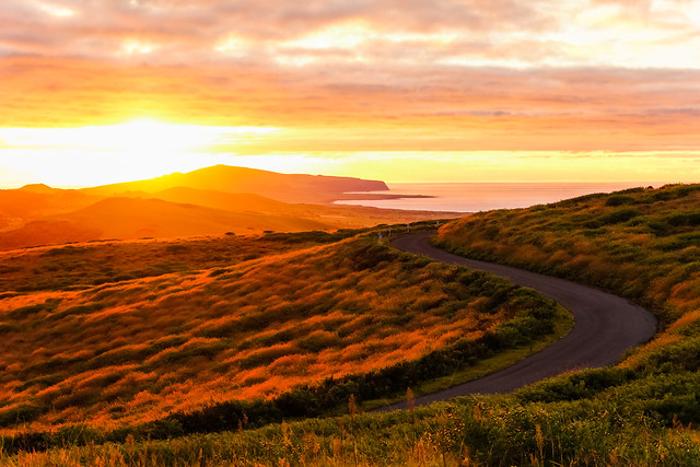
I became obsessed with this winding road and the colors of the sunrise.

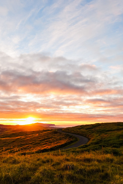
OBSESSED, I tell ya’!
after a small break, we continued on to…
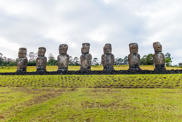
ahu akivi
Ahu Akivi is the most inland of the restored ahus, and is special because of its orientation to the sun during the spring and autumn equinoxes. the moai here, unlike most of the rest, face out to sea, which is visible way in the distance.
Another cloudy morning 🙁
The view towards the water
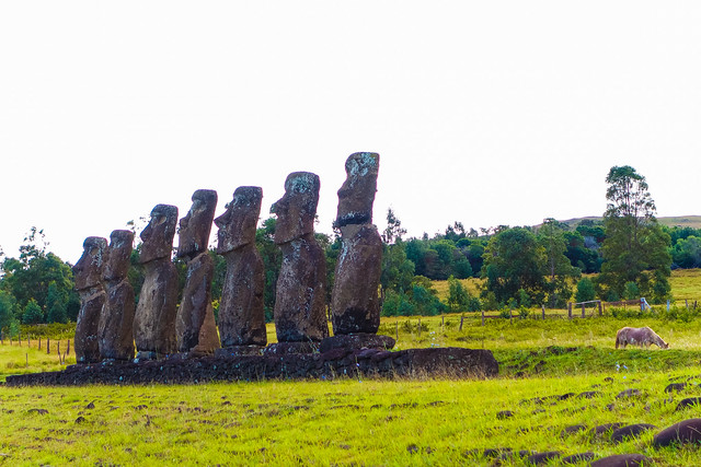
The seven moai. And a grazing cow.
we continued on to where the red tophats were created.
puna pau
this smallish crater was the home to the scoria that the Rapa Nui used to form the pukao, the red tophats that you can still see on a small handful of moai (or on the ground next to toppled ones). many are left there, much like the incomplete moai found at Rano Raraku.
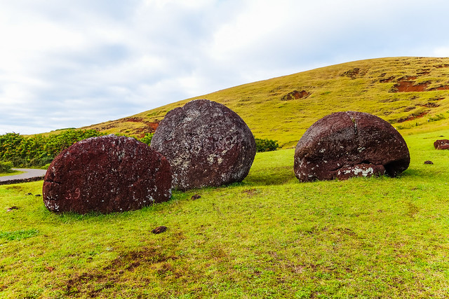
Much man-made damage has been done to these poor pukao over the years before they were barricaded off.

Panorama looking back towards civilization
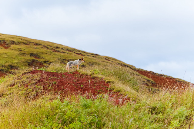
This was the mascot dog of Puna Pau, greeting us when we got out of the car and following us up the hill.
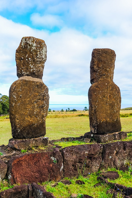
vinapu
we rounded the eastern edge of the airport runway to get to Ahu Vinapu, not particularly famous for the toppled moai or the other ritualistic remnants of the Rapa Nui civilization of centuries ago, but for the high technical quality of the stonemasonry of the ahu.
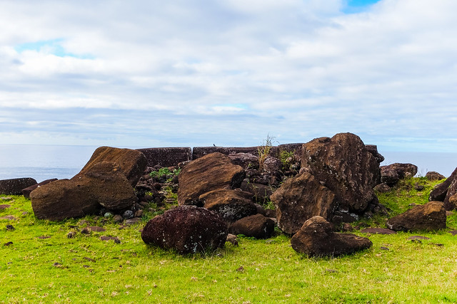
Toppled moai

Looking up the coast
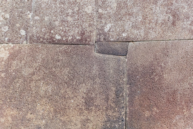
Head around to the back of the ahu and note how well the large stone slabs (still) fit together.
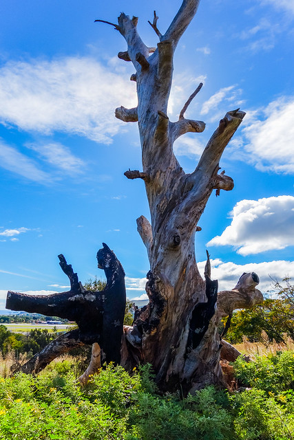
Just a pretty tree trunk I saw on the drive back to town
we headed back to Hanga Roa for a quick bite to eat (empanadas, of course) and continued on to…
ana kai tangata
the seaside cliffs south of Hanga Roa are stunning, but once you head out a bit and look back, you’ll see something even more amazing, seaside caves that have been dug out by eons of crashing waves.

The cliffs that form the edge of the Rano Kau crater and a rocky projection into the water
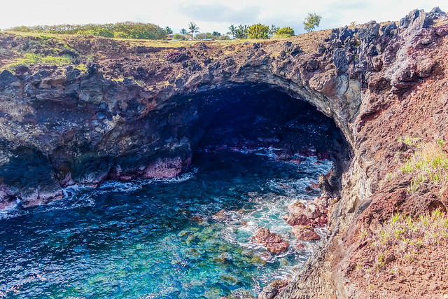
One of the caves
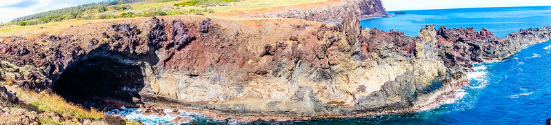
Looking back over everything. There’s another big cave on the other side of the strip of land.
this was about the time when the afternoon plane from Santiago was supposed to land, so once we heard it overhead we knew it was going to turn around for final approach and we raced over to the end of the runway to watch it land overhead (more on this in my First Timer post). it’s not far, but man did we hustle to the car and speed off!
orongo
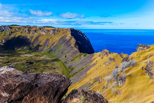
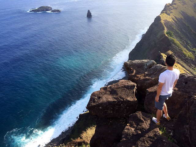
the final stop of the day was Orongo, the ceremonial village that played a central role in the annual Birdman competition. it’s located on the west end of the Rano Kau crater, which i was very familiar with, and yet still very fond of. the squat houses of the village have been reconstructed, but the view over the three islets (of Birdman competition fame) and the petroglyphs were more impressive to me. well, those and the view of the crater lake, since this was the best place to get a view of where i stood on the very first day, when i felt like king of the world.
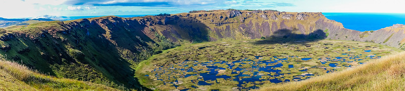
My very good friend the crater lake, taken from almost the same spot we were at for sunrise.
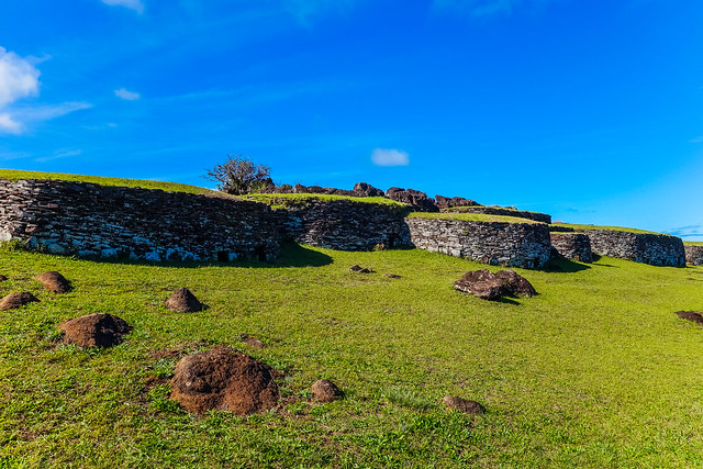
The reconstructed village of Orongo
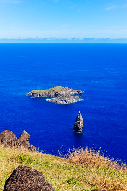
The islets of Motu Nui, Motu Iti, and Motu Kau Kau (back to front)
I stood at the top of the rise over there, on the brink of everything all at once. Amazing.

Putting this picture from Day 1 in here as a reference.
the rest of the day
i had about five hours before my flight, so i spent it walking around town and trying to get things to upload on the super slow internet connection the island has. i also ate more than my fair share of ice cream and stopped by the church. this also happened to be when Chile was playing Australia in the World Cup. most of the establishments in town were closed (it was almost like a ghost town), but when Chile won, it burst back to life — and how!
In fact, a mini-parade of honking vehicles filled with cheering Chileans just passed me down by the water. pic.twitter.com/j0cDqwKETl
— Jonathan Khoo (@jonk) June 14, 2014
a popular cheer:
¡Chi chi chi! ¡Le le le! ¡Vi Va Chi Le!
— Jonathan Khoo (@jonk) June 14, 2014
oh, speaking of flights, really no need to get to the airport two hours in advance, at least in the low season. an hour and a half was plenty.